Distance: 12.9 km
Duration: ~3h30
Difficulty: Moderate – Hard
Terrain: Coastal paths, rocky sections, fields
Best season: April–October
Start/Finish: Cap Fréhel lighthouse parking
Explore the full loop with distance and route overview. Click through to Komoot if you would like to follow it on the app.
When you arrive at Cap Fréhel it quickly becomes clear why this is one of the most dramatic headlands in Brittany. Even the drive to Cap Fréhel is spectacular. The road climbs steadily across open heathland before reaching the lighthouse at the tip of the peninsula.
From here the cliffs fall almost 70 metres into the sea, forming one of the most spectacular coastal landscapes along the Emerald Coast. These sandstone cliffs are home to thousands of nesting seabirds and the winds sweeping across the headland are rarely calm.
The peninsula is impressive not only for its cliffs. Behind the coastline lies a protected landscape of heather moorland, marsh and coastal heath, creating a striking contrast between wild coastal scenery and open inland fields.
This circular walk begins at the lighthouse and follows the GR34 along the cliffs toward Fort La Latte, before returning across the peninsula through heathland and farmland.
Route Description
This circular route begins at the Cap Fréhel lighthouse, where the GR34 coastal path leads south along the cliff tops. The first half of the walk follows the dramatic coastline, offering uninterrupted views across the Channel and the Emerald Coast.
As the trail approaches Fort La Latte, the path descends slightly before circling the medieval fortress perched above the sea. This section offers some of the best viewpoints of the castle and the surrounding cliffs.
After passing the fort, the route turns inland and crosses the peninsula through open farmland and heathland. Here the landscape changes dramatically from exposed cliffs to quiet rural paths.
The trail eventually reconnects with the road leading back toward the lighthouse, completing the loop across one of Brittany’s most striking coastal landscapes.
On this hike look down as well as up. Especially after being blown away by the coastal beauty of the first half of the hike. Don’t forget to appreciate the changing landscape as you cut back across the peninsula. Visit in the springtime to see bright yellow gorse and pink sea thrift or in the summer to walk through a sea of purple heather.
1. Lighthouse Start
Begin at the lighthouse parking area and walk toward the headland. From here the GR34 coastal path leads south along the cliffs.
2. Seabird Cliffs
Watch the cliffs for nesting seabirds. The rock formation known as La Fauconnière is one of the busiest nesting sites along the headland.
3. Cliff-Top Path
Follow the GR34 trail along dramatic sandstone cliffs rising 70 metres above the sea. This stretch offers some of the most expansive views of the Emerald Coast.
4. Fort La Latte
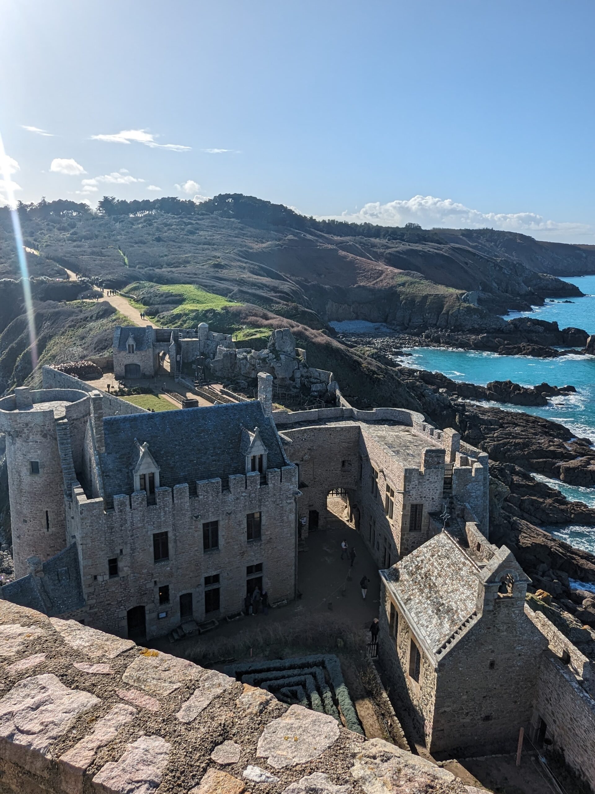
The path gradually descends toward Fort La Latte, the medieval fortress perched on a rocky promontory overlooking the sea. This is one of the most spectacular viewpoints on the walk.
5. Crossing the Peninsula
After passing the fort, leave the coastal path and turn inland. The route cuts across the peninsula through quiet farmland and coastal heath, offering a calmer contrast to the exposed cliffs.
6. Return to Cap Fréhel
Continue north across the peninsula before rejoining paths leading back toward the lighthouse. The final stretch returns you to Cap Fréhel, completing the loop.
Points of Interest
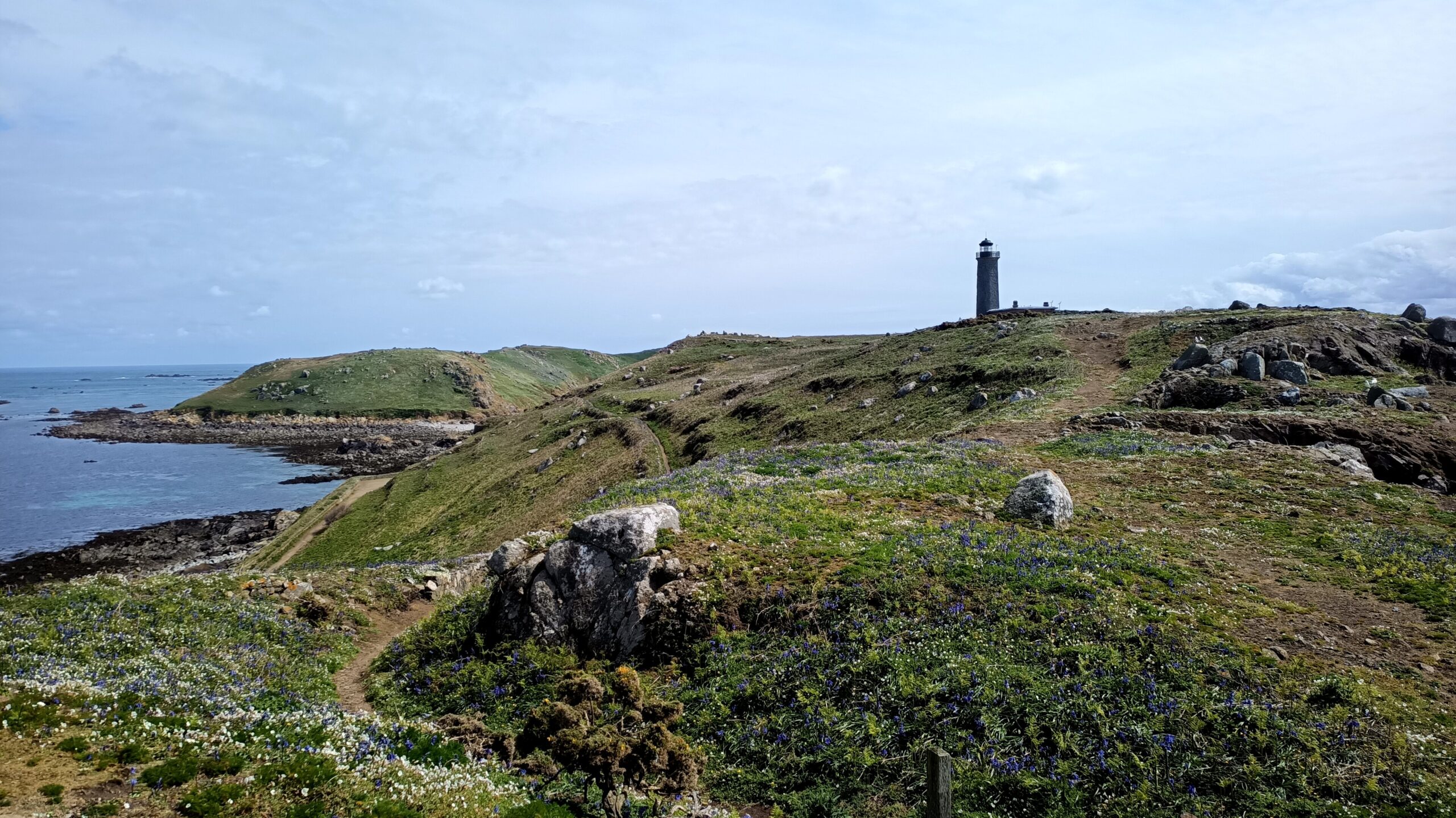
- The First lighthouse: The remains of the original 18th-century lighthouse still stand beside the modern structure.
- The Second Lighthouse: A larger lighthouse built in the 19th century replaced the original but was destroyed during the Second World War after being used as an observation post.
- The Current Cap Fréhel Lighthouse: Completed in 1950, the current lighthouse is one of the most powerful in France. Its lantern sits more than 100 metres above sea level and its beam can be seen up to 53 kilometres away. From April to October you can climb the 145 steps to enjoy a panorama.
- Fort la Latte: OAlso known as La Roche Goyon, this 14th-century fortress stands on a rocky promontory overlooking the sea. Its strategic position once controlled access along this stretch of coastline.
Practical Tips
Exposure: The headland is very windy and exposed. Bring layers even in summer.
Footwear: Comfortable walking shoes with grip; paths are rocky in sections and muddy in others.
Safety: Shade is limited on this hike. Bring water and sun protection in summer.
Water & Snacks: Nowhere to stock up on the trail. Bring provisions.
Shorter Alternative
Distance: 8.8 km
Duration: ~2h30
Difficulty: Easy – Moderate
Start/Finish: Cap Fréhel lighthouse parking
This out and back takes in the two iconic features of the peninsula – the Cap Fréhel lighthouse and the castle of Fort La Latte. Walk the very edge of the headland at the top of it’s dramatic cliffs.